Alta, Illinois
From Wikipedia, the free encyclopedia
Alta, Illinois | |
|---|---|
  Alta, Illinois | |
| Coordinates: 40°48′39″N 89°38′03″W / 40.81083°N 89.63417°W | |
| Country | United States |
| State | Illinois |
| County | Peoria |
| Elevation | 751 ft (229 m) |
| Time zone | UTC-6 (Central (CST)) |
| • Summer (DST) | UTC-5 (CDT) |
| Area code | 309 |
| GNIS feature ID | 403461[1] |
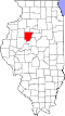
Alta is an unincorporated community on the northwest border of Peoria in Peoria County, Illinois, United States. Alta is 8 miles (13 km) north-northwest of downtown Peoria. The decommissioned Illinois State Route 174 runs through Alta, and the Rock Island Trail begins in Alta.