Rosefield Township, Peoria County, Illinois
From Wikipedia, the free encyclopedia
Rosefield Township | |
|---|---|
Township | |
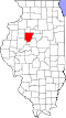
 Location in Peoria County | |
 Peoria County's location in Illinois | |
| Country | United States |
| State | Illinois |
| County | Peoria |
| Established | November 6, 1849 |
| Area | |
• Total | 36.53 sq mi (94.6 km2) |
| • Land | 36.38 sq mi (94.2 km2) |
| • Water | 0.15 sq mi (0.39 km2) 0.41% |
| Population (2010) | |
| 1,210 | |
| • Density | 33.5/sq mi (12.9/km2) |
| Time zone | UTC-6 (CST) |
| • Summer (DST) | UTC-5 (CDT) |
| FIPS code | 17-143-65715 |
Rosefield Township is located in Peoria County, Illinois. At the 2010 census, its population was 1,217 and it contained 489 housing units.[2]
According to the 2010 census, the township has a total area of 36.53 square miles (94.6 km2), of which 36.38 square miles (94.2 km2) (or 99.59%) is land and 0.15 square miles (0.39 km2) (or 0.41%) is water.[2]