Blackfoot, Montana
From Wikipedia, the free encyclopedia
Blackfoot, Montana | |
|---|---|
 Interactive map of Blackfoot, Montana | |
| Coordinates: 48°34′38″N 112°52′30″W / 48.57722°N 112.87500°W | |
| Country | United States |
| State | Montana |
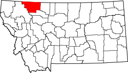
| County | Glacier |
| Area | |
• Total | 0.34 sq mi (0.88 km2) |
| • Land | 0.34 sq mi (0.88 km2) |
| • Water | 0 sq mi (0.00 km2) |
| Elevation | 4,154 ft (1,266 m) |
| Population (2020) | |
• Total | 109 |
| • Density | 322/sq mi (124.3/km2) |
| FIPS code | 30-07300 |
| GNIS feature ID | 2806620[2] |
Blackfoot is a census-designated place along the Flatiron[3] and Willow[4] creeks on the Blackfeet Nation in Glacier County, Montana, United States, about 26 miles (42 km) west of Cut Bank. As of the 2020 census, Blackfoot had a population of 109.[5]
U.S. Route 2 passes by the southeast edge of the community.[6]