Cape Girardeau Township, Cape Girardeau County, Missouri
From Wikipedia, the free encyclopedia
Cape Girardeau Township | |
|---|---|
 | |
| Coordinates: 37°18′46″N 089°32′25″W / 37.31278°N 89.54028°W | |
| Country | United States |
| State | Missouri |
| County | Cape Girardeau |
| Area | |
• Total | 70.5 sq mi (182.5 km2) |
| • Land | 67.08 sq mi (173.73 km2) |
| • Water | 3.39 sq mi (8.77 km2) 4.81% |
| Elevation | 390 ft (119 m) |
| Population (2000) | |
• Total | 37,778 |
| • Density | 563/sq mi (217.5/km2) |
| FIPS code | 29-11260[2] |
| GNIS feature ID | 0766397 |
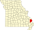
Cape Girardeau Township is one of ten townships in Cape Girardeau County, Missouri, USA. As of the 2000 census, its population was 37,778.
Geography
Cape Girardeau Township covers an area of 70.46 square miles (182.5 km2) and contains one incorporated settlement, Cape Girardeau. It contains fifteen cemeteries: County Memorial Park, Davis, Fairmon, Hitt, Hitt, Hitt, Lorimier, McGuire, Mount Auburn, Nunn, Old Hanover, Saint Marys, Salem, Shady Grove and Suedekum.
The streams of Cape La Croix Creek, Flora Creek, Juden Creek, Ramsey Branch, Randol Creek, Ranney Creek, Scism Creek and Sloan Creek run through this township.