Carlin Precinct, Calhoun County, Illinois
From Wikipedia, the free encyclopedia
Carlin Precinct | |
|---|---|
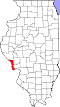
 Location in Calhoun County | |
| Coordinates: 39°21′11″N 090°39′12″W / 39.35306°N 90.65333°W | |
| Country |  United States United States |
| State |  Illinois Illinois |
| County | Calhoun |
| Organized | 1834 |
| Area | |
• Total | 23.36 sq mi (60.51 km2) |
| • Land | 22.73 sq mi (58.88 km2) |
| • Water | 0.63 sq mi (1.64 km2) 2.71% |
| Elevation | 617 ft (188 m) |
| Population (2020) | |
• Total | 92 |
| • Density | 4.0/sq mi (1.6/km2) |
| Time zone | UTC-6 (CST) |
| • Summer (DST) | UTC-5 (CDT) |
| ZIP code | 62053 |
| Area codes | 618/730 |
| FIPS code | 17-013-90630 |
| GNIS feature ID | 1928458[1] |
Carlin Precinct is located in Calhoun County, Illinois. The population was 92 at the 2020 census, a decline from 138 at the 2010 census.[2]
The precinct was formed in 1834 from Belleview Precinct as part of Illinois Precinct (comprising modern-day Carlin and Crater Precincts) and was separated in 1839.[3]