Center Township, Emmet County, Iowa
From Wikipedia, the free encyclopedia
Center Township | |
|---|---|
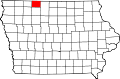
 Location in Emmet County | |
| Coordinates: 43°23′19″N 94°43′24″W / 43.38861°N 94.72333°W | |
| Country | |
| State | |
| County | Emmet |
| Area | |
• Total | 36.00 sq mi (93.24 km2) |
| • Land | 35.58 sq mi (92.15 km2) |
| • Water | 0.42 sq mi (1.09 km2) 1.17% |
| Elevation | 1,319 ft (402 m) |
| Population (2000) | |
• Total | 459 |
| • Density | 13/sq mi (4.9/km2) |
| Time zone | UTC-6 (CST) |
| • Summer (DST) | UTC-5 (CDT) |
| ZIP codes | 51334, 51344 |
| GNIS feature ID | 0467575 |
Center Township is one of twelve townships in Emmet County, Iowa, United States. As of the 2000 census, its population was 459.[1]
Center Township was created in 1876. It was named from its central location.[2]
Geography
According to the United States Census Bureau, Center Township covers an area of 36.45 square miles (94.41 square kilometers); of this, 36.03 square miles (93.32 square kilometers, 98.85 percent) is land and 0.42 square miles (1.09 square kilometers, 1.15 percent) is water.
Cities, towns, villages
Adjacent townships
- Ellsworth Township (north)
- Lincoln Township (northeast)
- Swan Lake Township (east)
- Jack Creek Township (southeast)
- High Lake Township (south)
- Twelve Mile Lake Township (southwest)
- Estherville Township (west)
- Emmet Township (northwest)
Cemeteries
The township contains Swan Lake Village Cemetery.
Major highways
Airports and landing strips
- Estherville Municipal Airport
School districts
- Estherville Lincoln Central Community School District