High Lake Township, Emmet County, Iowa
From Wikipedia, the free encyclopedia
High Lake Township | |
|---|---|
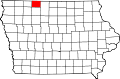
 Location in Emmet County | |
| Coordinates: 43°18′07″N 94°44′00″W / 43.30194°N 94.73333°W | |
| Country | |
| State | |
| County | Emmet |
| Area | |
• Total | 35.7 sq mi (92.5 km2) |
| • Land | 33.39 sq mi (86.47 km2) |
| • Water | 2.33 sq mi (6.03 km2) 6.52% |
| Elevation | 1,266 ft (386 m) |
| Population (2000) | |
• Total | 461 |
| • Density | 14/sq mi (5.3/km2) |
| Time zone | UTC-6 (CST) |
| • Summer (DST) | UTC-5 (CDT) |
| ZIP codes | 51334, 51342, 51365 |
| GNIS feature ID | 0468033 |
High Lake Township is one of twelve townships in Emmet County, Iowa, United States. As of the 2000 census, its population was 461.[1]
Cities, towns, villages
According to the United States Census Bureau, High Lake Township covers an area of 35.71 square miles (92.5 square kilometers); of this, 33.38 square miles (86.47 square kilometers, 93.48 percent) is land and 2.33 square miles (6.03 square kilometers, 6.52 percent) is water.
- Wallingford (east three-quarters)
Adjacent townships
- Center Township (north)
- Swan Lake Township (northeast)
- Jack Creek Township (east)
- Vernon Township, Palo Alto County (southeast)
- Walnut Township, Palo Alto County (south)
- Lost Island Township, Palo Alto County (southwest)
- Twelve Mile Lake Township (west)
- Estherville Township (northwest)
Cemeteries
The township contains these two cemeteries: High Lake and Wallingford.
Major highways
Airports and landing strips
- Wallingford Landing Strip
Lakes
- Bur Oak Lake
- High Lake
- Ingham Lake
Landmarks
- Wolden County Park
School districts
- Estherville Lincoln Central Community School District
- Graettinger-Terril Community School District
- Armstrong-Ringsted Community School District