Erkerode
From Wikipedia, the free encyclopedia
Erkerode | |
|---|---|
 Coat of arms | |
Location of Erkerode
within Wolfenbüttel district 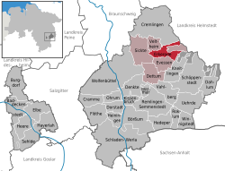 | |
 Location of Erkerode | |
 Erkerode  Erkerode | |
| Coordinates: 52°13′N 10°42′E / 52.217°N 10.700°E | |
| Country | Germany |
| State | Lower Saxony |
| District | Wolfenbüttel |
| Municipal assoc. | Sickte |
| Government | |
| • Mayor | Dr. Heinrich Füchtjohann (SPD) |
| Area | |
• Total | 13.34 km2 (5.15 sq mi) |
| Highest elevation | 180 m (590 ft) |
| Lowest elevation | 60 m (200 ft) |
| Population (2023-12-31)[1] | |
• Total | 845 |
| • Density | 63.3/km2 (164/sq mi) |
| Time zone | UTC+01:00 (CET) |
| • Summer (DST) | UTC+02:00 (CEST) |
| Postal codes | 38173 |
| Dialling codes | 05305 |
| Vehicle registration | WF |
Erkerode is a municipality in the District of Wolfenbüttel, in the south-east of Lower Saxony, Germany. It is nearly 16 kilometres (9.9 mi) south-east of Braunschweig. The Elm, a range of forested hills, is close by.
The town of Erkerode was first mentioned in historic documents in 1175 (Erikeroth). The village belonged to the noble family of Veltheim since the 12th century. It was part of the court of Destedt. There are still many medieval farm houses of various types to be seen in the village today.

