Haripur, Chanditala-I
From Wikipedia, the free encyclopedia
Haripur | |
|---|---|
Village | |
 Haripur Location in West Bengal, India  Haripur Haripur (India) | |
| Coordinates: 22°42′06″N 88°09′54″E / 22.7015782°N 88.1649503°E | |
| Country | |
| State | West Bengal |
| District | Hooghly |
| Government | |
| • Body | Gram panchayat |
| Population (2011) | |
• Total | 2,797 |
| Languages | |
| • Official | Bengali, English |
| Time zone | UTC+5:30 (IST) |
| PIN | 712701 |
| ISO 3166 code | IN-WB |
| Vehicle registration | WB |
| Lok Sabha constituency | Serampore |
| Vidhan Sabha constituency | Chanditala |
| Website | wb |
Haripur is a village and gram panchayat in Chanditala I community development block of Srirampore subdivision in Hooghly district in the Indian state of West Bengal.[1]
Gram panchayat
Haripur is located at 22°42′06″N 88°09′54″E / 22.7015782°N 88.1649503°E.
Villages in Haripur gram panchayat are: Anantarampur, Bade Sola, Baghati, Ban Panchbere, Chak Bangla, Chota Choughara, Dudhkomra, Haripur, Ichhapasar, Jagmohanpur, Mamudpur and Radhaballabhpur.[2]
 Map of Haripur GP
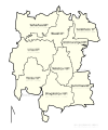 Map of Chanditala-I CD block sowing GP
 Map of Hooghly district showing CD blocks and municipal areas


