Kirk, Colorado
From Wikipedia, the free encyclopedia
Kirk, Colorado | |
|---|---|
 Kirk post office (2017) | |
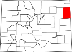
 Location within Yuma County and Colorado | |
| Coordinates: 39°36′46″N 102°35′31″W / 39.6126887°N 102.5919946°W[1] | |
| Country | United States |
| State | Colorado |
| County | Yuma |
| Area | |
• Total | 4.101 sq mi (10.622 km2) |
| • Land | 4.101 sq mi (10.622 km2) |
| • Water | 0 sq mi (0.000 km2) |
| Elevation | 4,203 ft (1,281 m) |
| Population | |
• Total | 61 |
| • Density | 15/sq mi (5.7/km2) |
| Time zone | UTC−7 (MST) |
| • Summer (DST) | UTC−6 (MDT) |
| ZIP Code | 80824[4] |
| Area code | 970 |
| FIPS code | 08-40900 [1] |
| GNIS ID | 2583255 [1] |
Kirk is an unincorporated town and a census-designated place (CDP) in Yuma County, Colorado, United States.[1] At the United States Census 2020, the population of the Kirk CDP was 61.
The Kirk post office has been in operation since 1887, with an original name of Kim.[5] The Kirk post office has the ZIP Code 80824.[4]
The community was established by A. Newkirk, and named for him.[6] "Kirk" is the Scots language word for "church".
Kirk is home to a grain elevator, meat processing plant, bank, grocery, feed and supply store and the post office.
Geography
The Kirk CDP has an area of 2,625 acres (10.622 km2), all land.[2]
Demographics
The United States Census Bureau initially defined the Kirk CDP for the United States Census 2010.
| Census | Pop. | Note | %± |
|---|---|---|---|
| 2010 | 59 | — | |
| 2020 | 61 | 3.4% | |
| U.S. Decennial Census | |||