Laurier, Washington
From Wikipedia, the free encyclopedia
Laurier, Washington | |
|---|---|
 Laurier  Laurier | |
| Coordinates: 48°59′56″N 118°13′27″W / 48.99889°N 118.22417°W | |
| Country | United States |
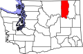
| State | Washington |
| County | Ferry |
| Area | |
• Total | 0.062 sq mi (0.16 km2) |
| • Land | 0.062 sq mi (0.16 km2) |
| • Water | 0 sq mi (0 km2) |
| Elevation | 1,654 ft (504 m) |
| Population (2020) | |
• Total | 4 |
| • Density | 65/sq mi (25/km2) |
| Time zone | UTC-8 (Pacific (PST)) |
| • Summer (DST) | UTC-7 (PDT) |
| ZIP code | 99146 |
| Area code | 509 |
| FIPS code | 53-38705[2] |
| GNIS feature ID | 2631350[1] |
Laurier is a census-designated place in Ferry County, Washington that neighbors the Canada–United States border.[3] The nearest school district is Orient School District.[4] According to the 2020 census, Laurier had a population of four permanent residents, up from a population of 1 in the 2010 Census.[5]
The initial name of the community was Russel but the origin of the namesake was uncertain at the time. When seeking to establish a post office, Russel was discovered to have been an ex-convict, prompting a search for a new name. The Great Northern Railway, which arrived in 1902, chose Boawell from a combination of two settlers named Boath and Kidwell respectively. Kidwell preferred Laurier, after Sir Wilfrid Laurier who was prime minister of Canada from 1896 to 1911,[6] and that name prevailed as did the post office opened that year.[7]
Infrastructure
The General Services Administration lists three buildings in Laurier, a border station and two border station residences, built in 1936.[8] U.S. Route 395 runs through the community north to the Canada–U.S. border, where it becomes British Columbia Highway 395. The Avey Field State Airport is in Laurier and its runway crosses the border into British Columbia.