Malo, Washington
From Wikipedia, the free encyclopedia
Malo, Washington | |
|---|---|
 Malo  Malo | |
| Coordinates: 48°48′06″N 118°36′25″W / 48.80167°N 118.60694°W | |
| Country | United States |
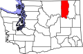
| State | Washington |
| County | Ferry |
| Area | |
• Total | 0.12 sq mi (0.31 km2) |
| • Land | 0.12 sq mi (0.31 km2) |
| Elevation | 2,182 ft (665 m) |
| Population (2020) | |
• Total | 32 |
| • Density | 251/sq mi (97/km2) |
| Time zone | UTC-8 (Pacific (PST)) |
| • Summer (DST) | UTC-7 (PDT) |
| ZIP code | 99150 |
| Area code | 509 |
| GNIS feature ID | 1522664[1] |
Malo is an unincorporated community in Ferry County, Washington, United States. Malo is located on Washington State Route 21 and is 12.5 miles (20.1 km) north-northeast of Republic. Malo has a post office with ZIP code 99150.[2] As of the 2020 census, Malo had a population of 32.[3] The community has the state's largest secondhand store, Malo Trading Post.[4]