List of Colorado county high points
From Wikipedia, the free encyclopedia
This is a list of the 64 counties of the U.S. State of Colorado by their points of highest elevation. Of the 50 highest county high points in the United States, 30 are located in Colorado. The highest point in Colorado and the Rocky Mountains as a whole is the summit of Mount Elbert in Lake County at 14,440 feet (4,401.2 m).

The 64 counties of the U.S. State of Colorado
Of the 64 Colorado counties, 20 counties rise above 14,000 feet (4,267 m) elevation, 32 counties rise above 13,000 feet (3,962 m), 42 counties rise above 10,000 feet (3,048 m), and all 64 Colorado counties rise above 4,116 feet (1,255 m).
Use the "Map this section's coordinates" link to view the location of each of the Colorado county high points.
Colorado county high points
Gallery
 1. Mount Elbert in Lake County
 2. Mount Harvard in Chaffee County

 7. Crestone Peak in Saguache County
 8. Mount Lincoln in Park County
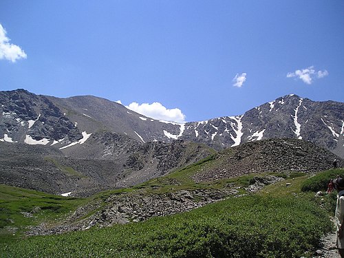
 14. Longs Peak in Boulder County
 15. Mount Wilson in Dolores County
 16. Mount Sneffels in Ouray County
 17. Pikes Peak in El Paso County
 18. Windom Peak in La Plata County
 19. Wilson Peak in San Miguel County

_-_2006-07-16.jpg)


See also


- Bibliography of Colorado
- Geography of Colorado
- History of Colorado
- Index of Colorado-related articles
- List of Colorado-related lists
- List of counties in Colorado
- List of Colorado counties by per capita income
- List of Colorado counties by population
- List of Colorado counties by socioeconomic factors
- List of Colorado counties by statistical area
- List of Colorado municipalities by county
- List of Colorado populated places by county
- List of county courthouses in Colorado
- List of county seats in Colorado
- List of mountain peaks of Colorado
- List of counties in Colorado
- Outline of Colorado
Notes
- The summit of Mount Elbert is the highest point of the Rocky Mountains, the State of Colorado, and Lake County.
- The elevation of Mount Elbert includes an adjustment of +1.995 m (6.55 ft) from NGVD 29 to NAVD 88.
- The summit of Mount Harvard is the highest point of the Collegiate Peaks and Chaffee County, Colorado.
- The elevation of Mount Harvard includes an adjustment of +2.084 m (6.84 ft) from NGVD 29 to NAVD 88.
- The summit of Blanca Peak is the highest point of the Sierra Blanca Massif, the Sangre de Cristo Mountains, Alamosa County and Costilla County, Colorado.
- The elevation of Blanca Peak includes an adjustment of +1.754 m (5.75 ft) from NGVD 29 to NAVD 88.
- The Blanca Peak Tripoint is the highest point of Huerfano County, Colorado. The Tripoint is located 140 feet (43 m) north-northeast and 25 feet (7.6 m) below the summit of Blanca Peak. The Tripoint is the junction of Alamosa, Costilla, and Huerfano counties. This point gave surveyors a better point to set the intersection of the three counties than the summit itself.
- The elevation of Blanca Peak Tripoint includes an adjustment of +1.755 m (5.76 ft) from NGVD 29 to NAVD 88.
- The summit of Uncompahgre Peak is the highest point of the San Juan Mountains and Hinsdale County, Colorado.
- The elevation of Uncompahgre Peak includes an adjustment of +1.967 m (6.45 ft) from NGVD 29 to NAVD 88.
- The summit of Crestone Peak is the highest point of the northern Sangre de Cristo Mountains and Saguache County, Colorado.
- The elevation of Crestone Peak includes an adjustment of +1.76 m (5.77 ft) from NGVD 29 to NAVD 88.
- The summit of Mount Lincoln is the highest point of the Mosquito Range and Park County, Colorado.
- The elevation of Mount Lincoln includes an adjustment of +2.098 m (6.88 ft) from NGVD 29 to NAVD 88.
- The summit of Castle Peak is the highest point of the Elk Mountains, Gunnison County and Pitkin County, Colorado.
- The elevation of Castle Peak includes an adjustment of +2.165 m (7.1 ft) from NGVD 29 to NAVD 88.
- The summit of Grays Peak is the highest point of the Front Range, the Continental Divide of North America, Clear Creek County and Summit County, Colorado.
- The elevation of Grays Peak includes an adjustment of +1.881 m (6.17 ft) from NGVD 29 to NAVD 88.
- The summit of Crestone East Peak is the highest point of Custer County, Colorado.
- Crestone East Peak is located 432 feet (132 m) east-northeast and 34 feet (10.4 m) below the summit of Crestone Peak.
- The elevation of Crestone East Peak includes an adjustment of +1.762 m (5.78 ft) from NGVD 29 to NAVD 88.
- The summit of Longs Peak is the highest point of the northern Front Range, Rocky Mountain National Park, and Boulder County, Colorado.
- The elevation of Longs Peak includes an adjustment of +1.652 m (5.42 ft) from NGVD 29 to NAVD 88.
- The summit of Mount Wilson is the highest point of the San Miguel Mountains and Dolores County, Colorado.
- The elevation of Mount Wilson includes an adjustment of +1.899 m (6.23 ft) from NGVD 29 to NAVD 88.
- The summit of Mount Sneffels is the highest point of the Sneffels Range and Ouray County, Colorado.
- The elevation of Mount Sneffels includes an adjustment of +1.879 m (6.16 ft) from NGVD 29 to NAVD 88.
- The summit of Pikes Peak is the highest point of the southern Front Range and El Paso County, Colorado.
- Pikes Peak is the easternmost 14,000-foot (4,267 m) summit of the United States. Pikes Peak was the inspiration for the lyrics of America the Beautiful..
- The elevation of Pikes Peak includes an adjustment of +1.678 m (5.51 ft) from NGVD 29 to NAVD 88.
- The summit of Windom Peak is the highest point of the Needle Mountains and La Plata County, Colorado.
- Mount Eolus may be higher than Windom Peak..
- The elevation of Windom Peak includes an adjustment of +1.785 m (5.86 ft) from NGVD 29 to NAVD 88.
- The summit of Wilson Peak is the highest point of San Miguel County, Colorado.
- The elevation of Wilson Peak includes an adjustment of +1.877 m (6.16 ft) from NGVD 29 to NAVD 88.
- The summit of Mount of the Holy Cross is the highest point of the northern Sawatch Range and Eagle County, Colorado.
- The summit elevation of Mount of the Holy Cross includes a vertical offset of +0.61 m (2 ft) from the station benchmark.
- The elevation of Mount of the Holy Cross includes an adjustment of +1.926 m (6.32 ft) from NGVD 29 to NAVD 88.
- The summit of Phoenix Peak is the highest point of Mineral County, Colorado.
- The elevation of Phoenix Peak includes an adjustment of +2.027 m (6.65 ft) from NGVD 29 to NAVD 88.
- The summit of Vermilion Peak is the highest point of San Juan County, Colorado.
- The elevation of Vermilion Peak includes an adjustment of +1.827 m (5.99 ft) from NGVD 29 to NAVD 88.
- The summit of West Spanish Peak is the highest point of Las Animas County, Colorado.
- West Spanish Peak is the easternmost 13,000-foot (4,000 m) summit of the United States..
- The elevation of West Spanish Peak includes an adjustment of +1.469 m (4.82 ft) from NGVD 29 to NAVD 88.
- The summit of Hagues Peak is the highest point of the Mummy Range and Larimer County, Colorado.
- The elevation of Hagues Peak includes an adjustment of +1.719 m (5.64 ft) from NGVD 29 to NAVD 88.
- The summit of Pettingell Peak is the highest point of Grand County, Colorado.
- The elevation of Pettingell Peak includes an adjustment of +1.864 m (6.12 ft) from NGVD 29 to NAVD 88.
- The summit of Summit Peak is the highest point of the southern San Juan Mountains and Archuleta County, Colorado.
- The summit elevation of Summit Peak includes a vertical offset of -0.15 m (-0.5 ft) from the station benchmark.
- The elevation of Summit Peak includes an adjustment of +1.877 m (6.16 ft) from NGVD 29 to NAVD 88.
- The summit of James Peak is the highest point of Gilpin County, Colorado.
- The elevation of James Peak includes an adjustment of +1.789 m (5.87 ft) from NGVD 29 to NAVD 88.
- The summit of Hesperus Mountain is the highest point of the La Plata Mountains and Montezuma County, Colorado.
- The elevation of Hesperus Mountain includes an adjustment of +1.65 m (5.41 ft) from NGVD 29 to NAVD 88.
- The summit of Bennett Peak is the highest point of Rio Grande County, Colorado.
- The elevation of Bennett Peak includes an adjustment of +1.782 m (5.85 ft) from NGVD 29 to NAVD 88.
- The summit of Conejos Peak is the highest point of Conejos County, Colorado.
- The elevation of Conejos Peak includes an adjustment of +1.792 m (5.88 ft) from NGVD 29 to NAVD 88.
- The summit of Bushnell Peak is the highest point of Fremont County, Colorado.
- The elevation of Bushnell Peak includes an adjustment of +1.737 m (5.7 ft) from NGVD 29 to NAVD 88.
- The summit of Devils Playground is the highest point of Teller County, Colorado.
- The Devils Playground is located 2.15 miles (3.46 km) northwest and 1,040 feet (317 m) below the summit of Pikes Peak. The Devils Playground is named for the way lightning sometimes dances around the prominence during lightning storms.
- The elevation of Devils Playground includes an adjustment of +1.611 m (5.29 ft) from NGVD 29 to NAVD 88.
- The summit of Clark Peak is the highest point of the Medicine Bow Mountains and Jackson County, Colorado.
- The summit elevation of Clark Peak includes a vertical offset of +1.83 m (6 ft) from the station benchmark.
- The elevation of Clark Peak includes an adjustment of +1.628 m (5.34 ft) from NGVD 29 to NAVD 88.
- The summit of Flat Top Mountain is the highest point of the Flat Tops and Garfield County, Colorado.
- The elevation of Flat Top Mountain includes an adjustment of +1.698 m (5.57 ft) from NGVD 29 to NAVD 88.
- The summit of Greenhorn Mountain is the highest point of the Wet Mountains and Pueblo County, Colorado.
- The elevation of Greenhorn Mountain includes an adjustment of +1.401 m (4.6 ft) from NGVD 29 to NAVD 88.
- The summit of Mount Zirkel is the highest point of the Park Range and Routt County, Colorado.
- The elevation of Mount Zirkel includes an adjustment of +1.632 m (5.35 ft) from NGVD 29 to NAVD 88.
- The summit of Buffalo Peak is the highest point of Jefferson County, Colorado.
- The elevation of Buffalo Peak includes an adjustment of +1.394 m (4.57 ft) from NGVD 29 to NAVD 88.
- The summit of Castle Rock is the highest point of Montrose County, Colorado.
- The summit of Mount Lamborn is the highest point of Delta County, Colorado.
- The elevation of Mount Lamborn includes an adjustment of +1.648 m (5.41 ft) from NGVD 29 to NAVD 88.
- The summit of Leon Peak is the highest point of Mesa County, Colorado.
- The elevation of Black Mountain includes an adjustment of +1.537 m (5.04 ft) from NGVD 29 to NAVD 88.
- The summit of Thunder Butte is the highest point of Douglas County, Colorado.
- The summit of Smoky Hill Ridge is the highest point of Arapahoe County, Colorado.
- The east slope of Carrizo Mountain is the highest point of Baca County, Colorado..
- Dry Bluff Southeast is the highest point of Otero County, Colorado..
- Overland Benchmark East is the highest point of Cheyenne County, Colorado..
- The summit of Shannon Benchmark is the highest point of Morgan County, Colorado.
- The south summit of Two Buttes is the highest point of Prowers County, Colorado..


