N1 highway (Philippines)
Highway in the Philippines
From Wikipedia, the free encyclopedia
National Route 1 (N1) is a primary national route that forms part of the Philippine highway network, running from Luzon to Mindanao. Except for a 19-kilometer (12 mi) gap in Metro Manila and ferry connections, the highway is generally continuous. Most sections of N1 forms the Pan-Philippine Highway except for sections bypassed by expressways.[1]
.svg) | ||||
|---|---|---|---|---|
| Route information | ||||
Part of  AH26 AH26 | ||||
| Maintained by the Department of Public Works and Highways | ||||
| Length | 3,858 km (2,397 mi) Excluding 19 km (12 mi) gap in Metro Manila | |||
| Existed | 2014–present | |||
| Luzon (Laoag–Pasay) | ||||
| Length | 1,410 km (880 mi) | |||
| North end |   N2 / N100 in Laoag N2 / N100 in Laoag | |||
| Major intersections |
| |||
| South end |   AH 26 (N120) / N61 in Pasay AH 26 (N120) / N61 in Pasay | |||
| Luzon (Muntinlupa–Matnog) | ||||
| Length | 784 km (487 mi) | |||
| North end |   N411 / N142 in Alabang, Muntinlupa N411 / N142 in Alabang, Muntinlupa | |||
| Major intersections |
| |||
| South end |  Port of Matnog Port of Matnog | |||
| Eastern Visayas | ||||
| Length | 397 km (247 mi) | |||
| North end |  N670 in Allen N670 in Allen | |||
| Major intersections |
| |||
| South end |  N691 in Liloan N691 in Liloan | |||
| Mindanao | ||||
| Length | 1,074.5 km (667.7 mi) | |||
| North end | Port of Lipata in Surigao City | |||
| Major intersections | ||||
| South end |    N966 / N970 / N971 in Zamboanga City N966 / N970 / N971 in Zamboanga City | |||
| Location | ||||
| Country | Philippines | |||
| Provinces | Ilocos Norte, Cagayan, Isabela, Nueva Vizcaya, Nueva Ecija, Bulacan, Laguna, Batangas, Quezon, Camarines Norte, Camarines Sur, Albay, Sorsogon, Northern Samar, Samar, Eastern Samar, Leyte, Southern Leyte, Surigao del Norte, Agusan del Norte, Agusan del Sur, Davao de Oro, Davao del Norte, Davao del Sur, Sarangani, South Cotabato, Maguindanao del Sur, Maguindanao del Norte, Lanao del Sur, Lanao del Norte, Zamboanga del Sur, Zamboanga Sibugay | |||
| Highway system | ||||
| ||||
| ||||


Route description
N1 follows a route that runs from Laoag in Ilocos Norte to Zamboanga City via Bicol Region, Eastern Visayas and eastern and southern parts of Mindanao. The highway connects most major regional centers on its route and runs through different landscapes. The highway is mostly named Maharlika Highway or National Highway, but other sections use different names, including alternative names assumed within some poblacions (city or town proper).[1]
Ilocos Region
N1 begins at the intersection with N2 (Manila North Road) and N100 (Laoag Airport Road) in Laoag as Manila North Road (MaNor). It then crosses Padsan River via Gilbert Bridge and enters the city proper of Laoag, where it splits before turning to the east in front of Ilocos Norte Provincial Capitol, where the Pan-Philippine Highway commences. It then briefly follows J.P. Rizal Avenue before turning to General Segundo Avenue; both are principal city streets passing through the city proper and through its outskirts. Approaching Bacarra, it becomes a rural highway. At Bacarra, it bypasses the town center to the north and runs through a rural area, and then enters Pasuquin, where it serves as a major municipal street. Between Bacarra and Burgos, it becomes a rural two-lane highway and passes through interspersed barangays along the South China Sea coastline. It soon climbs the mountains upon approach to Burgos, where the highway directly serves the town. The highway zigzags through the rough terrain and overlooks the beach where Bangui Wind Farm lies. It then passes through Bangui, where it runs as a major street on the town center, crosses Bulu River, and enters Pagudpud, where it bypasses the town proper. N1 runs through the foothills that mark the edge of the Cordillera Central mountain range and runs close to the coastline of Babuyan Channel, where the highway zigzags through the cliffs through the Patapat Viaduct, a 630-meter (0.39 mi) viaduct that is required for the highway to pass the steep cliffs marking the northern edge of the Cordillera Range.
 Gilbert Bridge, which carries N1 over the Padsan River in Laoag
 N1 turning point at the southern terminus of General Segundo Avenue in Laoag
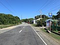 N1 in Burgos, Ilocos Norte
 N1 at Patapat Viaduct in Pagudpud
.jpg)
.jpg)
.jpg)

Cagayan Valley
Entering the Cagayan Valley region, N1 follows Manila North Road up to barangay Bangag, Aparri. From there, it turns south and becomes Bangag-Magapit Road up to the Magapit Interchange in Lal-lo. Within Lal-lo, N1 is also known as Logac–Magapit Road between namesake barangays Logac and Magapit. The segment includes the Magapit Suspension Bridge, which spans over the Cagayan River before meeting the Magapit Interchange.
At the interchange, it turns southeast and becomes Cagayan Valley Road from Magapit, Lal-lo to Tuguegarao, running parallel to the Cagayan River. In Tuguegarao, N1 turns east at the roundabout intersection with N106 (Tuguegarao Diversion Road) and N51 (Santiago–Tuguegarao Road) to bypass the city proper towards Peñablanca and run parallel to the Cagayan River up to Reina Mercedes, Isabela. It then enters the province of Isabela and Nueva Vizcaya as Maharlika Highway, although it is alternatively called Cagayan Valley Road up to Guiguinto, Bulacan. It serves as the main artery of Isabela alongside N51. In Santiago, Isabela, it turns southwest at the Mabini Rotonda, its intersection with N51, and becomes a one-way northbound route. Southbound traffic is redirected via R.C. Miranda Road and Boulevard to bypass this one-way section.
At Nueva Vizcaya, N1 runs parallel to and crosses the Magat River. In Solano, it navigates through the poblacion locally as J. Manzano Street, cutting through as J.P. Rizal Avenue, and finally exiting as Aquino Avenue towards its segment bypassing Bayombong poblacion. Further in Santa Fe, it then reaches the Dalton Pass, where Sierra Madre and Caraballo Sur meet.
Although Cagayan Valley Road is limited to Cagayan, its name also alternatively extends up to N1's section in Bulacan.

 N1 through the city proper of Cauayan, Isabela
 N1 in Santiago, Isabela
 N1 in Cordon, Isabela
 N1 as Aquino Avenue in Solano, Nueva Vizcaya
 N1 in Aritao, Nueva Vizcaya
.jpg)
.jpg)
.jpg)


.jpg)
Central Luzon
Nueva Ecija
The highway soon enters Nueva Ecija at Carranglan. It then descends to the plain terrain in San Jose as it approaches the poblacion. It then cuts through Muñoz and Talavera before turning east by its junction with N114 (Nueva Ecija–Pangasinan Road) in Santo Domingo. It then cuts through Talavera (once again, this time with the poblacion), Cabanatuan, Santa Rosa, San Leonardo and Gapan.
 N1 in San Jose
 N1 at the Cabanatuan–Talavera boundary
 N1 in San Leonardo
 N1 in Gapan
.jpg)


Bulacan
San Rafael to Guiguinto
_sign.svg) Doña Remedios Trinidad Highway | |
|---|---|
| DRT Highway | |
| Location | San Rafael – Pulilan, Bulacan |

N1 soon enters Bulacan at San Miguel, where it begins on a straight route. It then enters the poblacion of San Miguel, which it bypasses, and the highway begins to curve through most of its length between San Ildefonso and San Rafael, where the route runs through rice paddies. At its intersection with San Rafael Municipal Road, the highway curves to the southwest to follow Doña Remedios Trinidad Highway (DRT Highway) until the intersection of the old Cagayan Valley Road and Esguerra Street in Pulilan. DRT Highway serves as a bypass of the old Cagayan Valley Road through Baliwag poblacion. At Guiguinto, it crosses the North Luzon Expressway (NLEX) along with the Santa Rita Interchange, where Asian Highway 26 leaves for the expressway. Despite this split, the road continues to be known as the Maharlika Highway as it continues its course southwards. It soon crosses the original route of NLEX at Tabang Interchange.
Guiguinto to Meycauayan
.jpg)
Past Tabang Interchange, N1 begins to follow Manila North Road once again, this time as MacArthur Highway, which serves as a major toll-free highway over southern Bulacan. It soon crosses the Philippine National Railways right of way and enters Balagtas, where it directly passes through its poblacion. It soon crosses the Bigaa River, where it passes through residential and industrial areas, and curves upon entering Bocaue, where it bypasses the town center. A flyover restricted for use by light vehicles crosses Fortunato Halili Avenue to Santa Maria with service roads serving as frontage and heavy vehicle routes. The highway then curves and traverses through the residential barangays of Bocaue and soon enters Marilao and Meycauayan.
Metro Manila
Valenzuela to Pasay
_(EDSA-North_Triangle,_Quezon_City;_2017-02-22).jpg)
Entering Metro Manila, the highway follows MacArthur Highway over Valenzuela, which runs on a four to six-lane highway up to the Bonifacio Monument (Monumento) Circle in Caloocan. There, the Asian Highway 26 concurrency returns on N1 as it turns east to follow Epifanio de los Santos Avenue (EDSA) up to Pasay. The whole road, bypassing the capital city of Manila, runs through the central business districts of Metro Manila, most notably Araneta Center, Ortigas Center, and Makati Central Business District. The LRT Line 1 and MRT Line 3 utilizes the center island of EDSA on most segments between Caloocan and Pasay. N1 ends below the EDSA Flyover at N120/AH26/N61 (Roxas Boulevard) in Pasay.
A 19-kilometer (12 mi) gap in the highway is filled by the South Luzon Expressway (SLEX) and Skyway between Makati and Muntinlupa. It would have been filled by Taft Avenue Extension, starting from EDSA, going southwards via Quirino and Diego Cera Avenues and ends at Manila South Road below Alabang Viaduct through Alabang–Zapote Road.
Muntinlupa
Manila South Road | |
|---|---|
| National Road Old National Road Maharlika Highway | |
| Location | Muntinlupa – Calamba, Laguna |
| Length | 30.36 km[4][5] (18.86 mi) |
N1 resumes below the Alabang Viaduct of South Luzon Expressway (SLEX/E2/AH26) in Alabang, Muntinlupa, where it intersects with SLEX's Alabang Exit, East Service Road, N411 (Alabang–Zapote Road), and N142 (Montillano Street). The highway assumes the name Manila South Road, locally National Road or Old National Road, or Maharlika Highway, although this section does not assume the Asian Highway 26 concurrency, which is designated instead to SLEX. It runs as a commercial artery through the city up to the boundary with Laguna in San Pedro over the Tunasan River.
Calabarzon
San Pedro to Calamba
.jpg)
N1 generally serves as a four-lane toll-free highway serving the suburban cities of northwestern Laguna alongside the tolled South Luzon Expressway. Most sections of N1 between San Pedro and Calamba serve as commercial streets bypassing the old poblacions. Most of N1 is four-lane with a painted median divider.
It enters Laguna in San Pedro, where it serves as a major commercial street, with a maximum of four lanes. It then enters the cities of Biñan, Santa Rosa, Cabuyao, and Calamba, where it turns southwest past its intersections with N66 (Calamba–Pagsanjan Road) and N420-2 (Rizal Shrine Road) at the Calamba Crossing. In barangay Real, the highway is alternatively known as Real Road.
Calamba to Tayabas

N1 soon crosses the South Luzon Expressway at the Calamba Exit, where the concurrency with the Asian Highway 26 returns on the highway, and veers south. It then enters the province of Batangas at Santo Tomas, where it intersects with STAR Tollway and bypasses the poblacion. At the Santo Tomas Roundabout, where it meets N4 (Jose P. Laurel Highway) and Governor Carpio Avenue, it turns southeast as it leaves the province. It then re-enters the province of Laguna through Alaminos and then San Pablo, bypassing its poblacion.
N1 then enters the province of Quezon at Tiaong. There, it passes the Villa Escudero plantations and the site of the future Tiaong Interchange of SLEX Toll Road 4, then cuts through the poblacion as Doña Tating Street and then veers east as Don V. Robles Street. It then traverses the municipalities of Candelaria (as Rizal Avenue through the poblacion) and Sariaya (as General Luna Street through the poblacion) and the city of Tayabas, where it turns southeast towards Lucena at the Calumpang Junction.
Tayabas to Pagbilao
.jpg)
From Tayabas through Lucena, N1 then follows the entire Lucena Diversion Road (also known as MSR Diversion Road),[6][7][8] a wide road that bypasses the Old Manila South Road alignment, which cuts through Lucena poblacion, up to the road's eastern end in Pagbilao.
Pagbilao to Calauag
In Pagbilao poblacion, N1 briefly splits into MSR Diversion Road (collective name for the segment locally known as C.M. Recto Street and Pornobi Street, respectively) for westbound traffic and J.P. Rizal Street for eastbound traffic. Onto the area of the protected Quezon National Forest Park in the Sierra Madre, it then becomes alternatively known as New Diversion Road, the longer road bypassing the Old Zigzag Road alignment cutting through the park.
The route enters Atimonan, bypassing the poblacion before reaching Quezon’s eastern coastline. It then continues through Plaridel and then Gumaca, where it becomes J.P. Rizal Street in the poblacion south of the Gumaca River, then shifts eastward as A. Bonifacio Street toward Lopez. Within Lopez poblacion, it is known as General Vera Avenue before traversing Calauag.
Bicol Region
Santa Elena to Sipocot

N1 enters Camarines Norte at the municipality of Santa Elena, meeting the N68 (Andaya Highway) that serves as a southern bypass of N1 which traverses the sparsely populated province of Camarines Norte. After traveling through kilometers of jungle, N1 navigates through the poblacion of Labo. It then becomes a rural highway again, passing by the municipalities of Vinzons and Talisay before bypassing Daet. It passes through Bicol Natural Park where the road winds through mountainous and hilly terrain. N1 enters Camarines Sur at the municipality of Sipocot, where it meets again N68 at its eastern end.
Sipocot to Matnog
.jpg)
From Sipocot, N1 traverses the municipalities of Libmanan, Pamplona, San Fernando, and Milaor (where it is alternatively known as Mabolo Road) in Camarines Sur. N1 then enters Naga City, bypassing its poblacion as Roxas Avenue or Diversion Road before turning east at the Naga Rotonda to follow Maharlika Highway to enter Pili, the provincial capital. It then traverses the municipalities of Bula, Baao, Nabua, and Bato.
N1 enters the province of Albay at Polangui and traverses south of the Mayon Volcano. At Daraga poblacion, N1 turns sharply to the west as Rizal Street at its intersection with N630 (Rizal Avenue), which provides access to Legazpi, and becomes a zigzag road as it leaves the province.
N1 enters the province of Sorsogon at Pilar. It then enters Sorsogon City, where it cuts through the poblacion as Rizal Street and Magsaysay Street, respectively. It turns east and veers south at the Abuyog Junction, also in Sorsogon City, as it continues its course north and east of Sorsogon Bay. It then traverses the municipalities of Casiguran and Juban. It then traverses west of Mount Bulusan and enters the towns of Irosin and Matnog, where its Luzon section ends at the Port of Matnog. Motorists can board a ferry to either Allen or San Isidro in Northern Samar at the port.
Eastern Visayas
Samar Island
.jpg)
The Visayas section of N1 begins at the intersection with N670 (Allen–Catarman Road / Allen Diversion Road) and Allen Old Road in Allen, Northern Samar, just south of the Port of Allen. It runs mostly along the western coast of Samar Island, particularly the provinces of Northern Samar and Samar and notably through the latter's cities of Calbayog and Catbalogan. Through the Calbayog poblacion west of the Calbayog River, it is also known as Jose D. Avelino Street or Senate President Jose Avelino Avenue. In the poblacion of Santa Margarita, Samar, it briefly becomes a one-way southbound road as northbound traffic is diverted to the Santa Margarita Old Route, which covers short segments of Ramon Calagos and Barrantes Streets. It then climbs a mountainous terrain as it approaches Gandara, where it straddles along the Gandara River and Tan-Correche Creek. It then enters the landlocked town of San Jorge and returns to the western coast of Samar at Tarangnan. Further south in Catbalogan, it traverses through the poblacion along local streets such as Del Rosario Street (where it briefly splits at the junction with Mabini Avenue, in front of Saint Mary's College of Catbalogan), Curry Avenue, San Roque Street, and Rizal Avenue Extension. From Paranas, it climbs another mountainous terrain into the island. It turns west at its intersection with N670 (Dolongan–Basey Road) in Basey as it leaves the island of Samar at Santa Rita and crosses the San Juanico Strait through the San Juanico Bridge.
Leyte Island

.jpg)
Past the San Juanico Bridge, N1 enters the province of Leyte at Tacloban, straddling near the eastern coast of Leyte Island. At the roundabout intersection with Naga-naga–Anibong Road, the highway traverses the southbound lane, bypassing the poblacion. It then enters Palo and turns southwest at the intersection with N686 (Tacloban–Baybay South Road / Government Center Road Network), where a monument to an unknown soldier is located. From this point, the road assumes the name Tacloban–Baybay South Road as it proceeds to the Palo poblacion. At its intersection with N70/AH26 (Palo–Santa Fe Road / San Salvador Street) and Pio Pedrosa Avenue at the vicinity of the Palo Cathedral, it then turns southeast to other towns at the eastern coast of Leyte. At Abuyog, it veers west, away from the poblacion, and climbs the Leyte Cordillera mountain range. It enters Mahaplag, where the Tacloban–Baybay South Road diverges from the highway at the Mahaplag Triangle to continue toward the intersecting N70/AH26. It enters Southern Leyte at Sogod, where Agas-Agas Bridge is located, and descends the mountain range. It then follows the eastern coastline of Sogod Bay and enters the towns of Libagon and Liloan.
Panaon Island
In Liloan, N1 crosses the Panaon Strait through the Wawa Bridge and enters Panaon Island. There, its Visayas section ends at its intersection with N691 and the road serving the Port of Liloan, where motorists can board a ferry to Surigao City.
Caraga
Davao-Agusan National Highway | |
|---|---|
| Location | Butuan – Davao City |
The Mindanao section of N1 starts at the Port of Lipata in Surigao City. It then turns south at its intersection with Surigao Wharf Road, also in Surigao City, to run parallel to the Surigao River. It enters Agusan del Norte and takes up the section Surigao–Butuan National Highway from Kitcharao to Ampayon, Butuan, where it turns southeast at its intersection with Butuan–Cagayan de Oro–Iligan Road (N9) to assume the name Davao–Agusan National Highway from thereon. It then enters Agusan del Sur, where it traverses near the Agusan Marsh Wildlife Sanctuary.
Davao Region

N1 enters Davao de Oro (formerly Compostela Valley) at Monkayo and goes through mountainous terrain as it heads south towards Tagum in Davao del Norte. At the boundary of Tagum and Carmen, Davao del Norte, the highway briefly splits into two as it crosses the Libuganon River.
The route enters Panabo and Davao City, where it then follows the full length of the Carlos P. Garcia National Highway that bypass the city proper; at this junction, the AH26 designation departs from the N1 alignment to traverse the city proper via N916-5. At the southern terminus of the diversion road, N1 reunites with AH26 as it merges into the Davao-Cotabato Road, which is locally known as MacArthur Highway within Davao City. It then proceeds into Santa Cruz, Davao del Sur, traversing the municipality's eastern coastline but bypassing the municipal proper.
Digos–Makar Road | |
|---|---|
| Davao–GenSan Highway | |
| Location | Digos – General Santos |
| Length | 91.78 km[9][10][11] (57.03 mi) |
It enters Digos, where it turns west at its intersection with N923 (Digos Diversion Road) and then south at its intersection with N75 to assume the name Digos–Makar Road or Davao–GenSan Highway as it traverses the mountainous terrains up to General Santos. In the Digos city proper, it is locally known as Rizal Avenue.
Soccsksargen
.jpg)
Marbel-Makar Road | |
|---|---|
| Location | General Santos – Koronadal, South Cotabato |
| Length | 20.66 km[11][12] (12.84 mi) |
Cotabato-Marbel Road | |
|---|---|
| Location | Koronadal, South Cotabato – Isulan, Sultan Kudarat |
| Length | 51.67 km[12] (32.11 mi) |
N1 enters Sarangani at Malungon, where it runs parallel to Malungon River from there. At General Santos, it is locally known as Jose Catolico Sr. Avenue until turning west to pass by the poblacion. It turns north at its intersection with N935 (Hadano Avenue) at Hadano Park to assume the name Marbel–Makar Road, alternately known up to Polomolok as General Santos–Polomolok National Road (GenSan–Polomolok National Road) or Polomolok National Highway. At Koronadal poblacion, the highway turns southwest at Marbel Roundball, a roundabout intersection with N940 (Midsayap–Marbel Road) and Koronadal–Lutayan–Columbio Road, and assumes the name Cotabato–Marbel Road up to Isulan. The highway veers northwest at Surallah and enters Sultan Kudarat at Isulan, where it becomes Marbel–Allah Valley–Cotabato Road.
Bangsamoro Autonomous Region
Ampatuan to Cotabato City
N1 enters Bangsamoro Region at Ampatuan, Maguindanao del Sur, as it crosses a river as Kakal Bridge. It then enters Maguindanao del Norte at Talitay (Sultan Sumagka). It retains the name Marbel–Allah Valley–Cotabato Road up to Cotabato City. It enters the Cotabato City proper, where it assumes the local name Sinsuat Avenue.
Cotabato City to Picong

At the junction of Sinsuat, Quezon, and Don Teodoro V. Juliano Avenues, N1 turns east to assume the name Cotabato–Lanao Road up to Matanog, Maguindanao del Norte; its section from the junction to Sultan Kudarat, Maguindanao del Norte is also known as Quezon Avenue. Near barangay Crossing Simuay, Sultan Kudarat, it takes the longer, circumferential path as it meets the western terminus of N75 (Davao–Cotabato Road). From Sultan Mastura to Parang, it follows the diversion road that bypasses the poblacion of these towns.
Entering Lanao del Sur at Sultan Dumalondong, N1 becomes Cotabato–Malabang–Lanao del Norte Road as it would also traverse Malabang. In Balabagan, it assumes the alternate name Rizal Avenue as it approaches near the coast of Lanao del Sur with Celebes Sea up to Picong, the last municipality traversed by N1 before leaving Bangsamoro.
N1's section from Sultan Kudarat, Maguindanao del Norte, to Balabagan, Lanao del Sur, is also known as Narciso Ramos Highway.
Northern Mindanao
N1 enters Lanao del Norte at Sultan Naga Dimaporo, the only municipality it passes through in Northern Mindanao. It traverses along the southern coast of the province. Within the region and province, it is alternatively known as Malabang–Dobleston–Tukuran Road as it traverses Barangay Dabliston.
Zamboanga Peninsula
Lanao-Pagadian-Zamboanga City Road Pagadian City-Zamboanga City Road | |
|---|---|
| Location | Tukuran, Zamboanga del Sur – Zamboanga City |

N1 enters Zamboanga del Sur at Tukuran, where it becomes alternatively known as Tucuran Junction–Karomatan Junction Road or Malabang–Tukuran Road as it approaches the poblacion, where it veers away from the province's coast along Pagadian Bay at the Tukuran poblacion, where it is locally known as Rizal Avenue. At the Tukuran Junction, it turns west and becomes Lanao–Pagadian–Zamboanga City Road and Pagadian City–Zamboanga City Road from thereon. It climbs the mountainous terrain and turns west at its intersection with N9 (Butuan–Cagayan de Oro–Iligan Road) to become alternatively known as National Highway. It then cuts through Pagadian, where it is a principal route locally known as J.P. Rizal Avenue through the poblacion. It enters Zamboanga Sibugay, passing through the mountainous terrain and municipalities on the province's southern coast.
N1 enters Zamboanga City as Maria Clara L. Lobregat Highway. It then enters the city proper, where it turns south as Veterans Avenue at the Sta. Cruz Junction, then southwest as Governor Lim Avenue, which carries one-way northeast-bound traffic, and finally southwest as Don Pablo Lorenzo Street. It ends at the intersection with N970 (N.S. Valderosa Street), N966 (Zamboanga City-Labuan-Limpapa Road/J.S. Alano Street/Calle Guardia Nacional), and N971 (Wharf Road/Don Pablo Lorenzo Street), its physical continuation towards the Port of Zamboanga. This junction is situated near the Zamboanga City Hall, the city's Rizal Park, and the Universidad de Zamboanga - City Campus.
History
The current alignment of N1 was formed by the integration and expansion of several colonial-era and post-war highway systems. Its direct predecessors included:[13][14][15][16][17][18][19]
- Segments of Highway 3 (Manila North Road) from Laoag to Aparri and from Pulilan to Caloocan
- Majority of Highway 5 (Cagayan Valley Road) from Lal-lo to Pulilan
- Highway 54 (present-day EDSA) then in Rizal
- Majority of Highway 1 (Manila South Road) from Muntinlupa to Matnog, including the Calamba–Santo Tomas segment of the Manila–Batangas Road[20]
- Highway 1 as Samar–Leyte Road from Calbayog to Santa Rita and as Leyte–Samar Road from Tacloban to Mahaplag and from Sogod to Liloan.
- Highway 1 as Agusan–Surigao Road in the old Surigao and Agusan provinces, Agusan–Davao Road in the old Agusan and Davao provinces, and as Davao–Cotabato Road from Davao City to Digos
- Highway 5 (Lanao–Cotabato Road) from Dadiangas (present-day General Santos) to Mamasapano
- Highway 1 (Cotabato–Lanao Road) from Sultan Kudarat to Malabang
- Lanao–Zamboanga Road
More roads were later constructed and added to integrate with the present alignment of N1 and Pan-Philippine Highway (also known as Maharlika Highway since 1979),[21] which was conceived in 1965 as the country's principal transport backbone and later designated as Asian Highway 26 (AH26).[22]
In 2014, the Department of Public Works and Highways assigned the segment of Pan-Philippine Highway from Laoag to Guiguinto and from Calamba to Zamboanga City, MacArthur Highway from Guiguinto to Caloocan, EDSA, and Manila South Road from Muntinlupa to Calamba as N1. The route was later realigned through newer bypass routes. It shifted from the original Simuay–Landasan–Parang Road (now N937) to a new bypass between Parang and Sultan Mastura in present-day Maguindanao del Norte, whereas, in 2025, the segment in Davao City was shifted from the Davao–Agusan and eastern Davao–Cotabato roads in the city proper to the Carlos P. Garcia National Highway (formerly N913).[23] The Pan-Philippine Highway designation, however, remained through the Davao City proper routes redesignated as N916-5.[1]
Junctions
Luzon
Laoag to Pasay
- Ilocos Norte


- Cagayan
 N223 in Abulug
 N121 in Abulug
 N101 / N119 at Magapit Interchange, Lal-lo
 N104 in Tuguegarao
 N105 in Tuguegarao
 N51 / N106 in Tuguegarao
- N104 in Tuguegarao


- Isabela
- N220-1 in Cabagan (northern terminus)
 N220 in Cabagan
- N220-1 in Cabagan (southern terminus)
- N220-1 in Tumauini
 N53 in Cauayan
- N51 in Santiago
- N108-1 in Santiago
 N108 in Cordon


- Nueva Vizcaya


- Nueva Ecija

 N56 / N111 in San Jose
 N114 in Santo Domingo
- N111 in Cabanatuan
 N58 in Santa Rosa
 N3 in Gapan

- Bulacan

 N247 in San Rafael
 N115 in Pulilan
 N116 in Plaridel
 AH 26 (E1) / E1 in Santa Rita, Guiguinto. End of AH26 concurrency.
 E1 / N2 in Tabang, Guiguinto
 N117 in Meycauayan


.jpg)

- Metro Manila
 N118 in Malinta, Valenzuela
 E5 in Karuhatan, Valenzuela
 N150 / AH 26 (N120) in Caloocan. Start of AH26 concurrency.
 AH 26 (E1) / N160 at Balintawak Interchange, Quezon City
 N127 in Unang Sigaw, Quezon City
 N129 in Muñoz, Quezon City
 N171 / N173 in Diliman, Quezon City
 N170 in Diliman, Quezon City
 N172 / N174 in Diliman, Quezon City
 N180 / N59 in Cubao, Quezon City
 N185 near Camp Aguinaldo, Quezon City
 N184 / N60 in Quezon City and Mandaluyong
 N141 in Mandaluyong
 N190 in Makati
 N191 in Makati
- N190 in Makati

 N145 / AH 26 (E2) at Magallanes Interchange, Makati
- N171 in Pasay
- N170 in Pasay
 N61 / AH 26 (N120) in Pasay. Southern terminus of Laoag–Pasay section.


Muntinlupa to Matnog
- Metro Manila

 N411 / N142 in Alabang, Muntinlupa. Northern terminus of Muntinlupa–Matnog section.
- N411 in Alabang, Muntinlupa
- AH 26 (E2) in Alabang, Muntinlupa

- Laguna (1st segment)
 N65 in Biñan
 N420 in Santa Rosa
- N420-1 in Calamba
 N66 in Calamba
- N420-2 in Calamba
 AH 26 (E2) / E2 in Calamba. Start of AH26 concurrency.


- Batangas
- E2 in Santo Tomas
- N421-2 in Santo Tomas (northern terminus)
 N4 / N421-2 in Santo Tomas
- Laguna (2nd segment)
- N421-1 in Alaminos (two eastern termini)
 N67 in San Pablo (two southern termini)
- N608-1 in San Pablo
.jpg)

- Quezon
- N608-1 in Tiaong
 N608 in Tiaong (northern terminus)
 N435 in Tiaong
- N608 in Tiaong (southern terminus)
 N609 in Candelaria
- N422-1 in Candelaria
- N609 in Candelaria
 N606 in Sariaya
- N606 in Isabang, Tayabas
 N422 in Isabang, Lucena
 N603 in Gulang-Gulang, Lucena
- N606 in Talipan, Pagbilao
 N610 in Silangang Malicboy, Pagbilao
- N613-2 in Atimonan
- N618-1 in Gumaca (western terminus)
 N613 in Gumaca
- N618-1 in Gumaca (eastern terminus)
- N612-1 in Lopez (western terminus)
 N611 in Lopez
 N612 in Lopez
- N612-1 in Lopez (eastern terminus)
 N657 in Lopez


- Camarines Norte
 N68 in Santa Elena
 N620 in Labo
 N621 in Daet (northern & southern termini)


- Camarines Sur
 N625 in Lupi
 N626 in Lupi
- N68 in Sipocot
 N623 in Pamplona
 N627 in San Fernando
 N672 in Pili
 N673 in Pili
 N630 in Pili
 N634 in Baao
- N634 in Nabua
 N635 in Bato


- Albay


- Sorsogon


Visayas
- Northern Samar
 N670 in Allen. Northern terminus of Visayas section.
- Samar
- N672 in Calbayog
- N673 in Calbayog
 N679 in Calbayog (western & eastern termini)
 N677 in Gandara (northern & southern termini)
 N675 in Catbalogan
 N674 in Paranas
- N670 in Basey
- N670 in Santa Rita


- Leyte
 N717 in Tacloban (northern terminus)
 N686 in Tacloban
 N687 in Tacloban
- N717 in Tacloban (southern terminus)
 N718 in Palo
- N686 in Palo
 N70 in Palo
 N719 in Palo
 N690 in Abuyog
- N70 in Mahaplag


- Southern Leyte

Mindanao
- Surigao del Norte
 N901 in Surigao City
 N902 in Placer


- Agusan del Norte

- Agusan del Sur
 N903 in Prosperidad
 N904 in Prosperidad
 N905 in San Francisco
 N904 / N73 in Trento


- Davao de Oro
 N906 in Montevista
 N907 in Nabunturan


- Davao del Norte
 N908 in Tagum (northern terminus)
 N909 / N74 in Tagum
- N908 in Tagum (southern terminus)
 N910 in Carmen
- N909 in Panabo


.jpg)
- Davao del Sur
- N918-1 in Davao City
- AH 26 (N916-5) in Davao City (eastern terminus). End of AH26 concurrency.
- N915-1 in Davao City
 N918 in Davao City
 N921 in Davao City
- AH 26 (N916-5) in Davao City (western terminus). Start of AH26 concurrency.
 AH 26 (N10) in Davao City
- N916-1 in Davao City
 N923 in Digos (northern terminus)
 N75 in Digos
 N924 in Digos
- N923 in Hagonoy (southern terminus)
 N930 in Sulop


- South Cotabato
 N931 in General Santos (eastern terminus)
- N930 in General Santos
 N935 in General Santos
- N931 in General Santos


- Sultan Kudarat


- Maguindanao del Sur
 N933 in Datu Saudi Ampatuan

- Maguindanao del Norte
- N75 in Sultan Kudarat
- N935 in Datu Odin Sinsuat
 N936 in Datu Odin Sinsuat
 N937 in Sultan Mastura
- N937 in Parang
 N939 in Parang


- Lanao del Sur

.jpg)
- Zamboanga del Sur
- Zamboanga Sibugay
- Zamboanga City
 N972
N972 N968
N968

 N966 / N970 / N971. Southern terminus of AH26.

