Mott Township, Franklin County, Iowa
From Wikipedia, the free encyclopedia
Mott Township | |
|---|---|
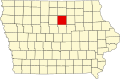
 Location in Franklin County | |
| Coordinates: 42°46′42″N 93°12′09″W / 42.77833°N 93.20250°W | |
| Country | United States |
| State | Iowa |
| County | Franklin |
| Area | |
• Total | 32.76 sq mi (84.85 km2) |
| • Land | 32.57 sq mi (84.36 km2) |
| • Water | 0.19 sq mi (0.49 km2) 0.58% |
| Elevation | 1,109 ft (338 m) |
| Population | |
• Total | 498 |
| • Density | 15/sq mi (5.9/km2) |
| Time zone | UTC-6 (CST) |
| • Summer (DST) | UTC-5 (CDT) |
| ZIP codes | 50441, 50475 |
| GNIS feature ID | 0468413[2] |
Mott Township is one of sixteen townships in Franklin County, Iowa, United States. As of the 2010 census, its population was 498 and it contained 237 housing units.[1]
Mott Township was organized in 1879. The Mott family were prominent landowners.[3]
Geography
School districts
- Hampton-Dumont Community School District