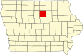
Osceola Township, Franklin County, Iowa
From Wikipedia, the free encyclopedia
Osceola Township | |
|---|---|
 Location in Franklin County | |
| Coordinates: 42°36′00″N 93°05′08″W / 42.60000°N 93.08556°W | |
| Country | United States |
| State | Iowa |
| County | Franklin |
| Area | |
• Total | 35.87 sq mi (92.91 km2) |
| • Land | 35.8 sq mi (92.8 km2) |
| • Water | 0.042 sq mi (0.11 km2) 0.11% |
| Elevation | 1,132 ft (345 m) |
| Population | |
• Total | 268 |
| • Density | 7.5/sq mi (2.9/km2) |
| Time zone | UTC-6 (CST) |
| • Summer (DST) | UTC-5 (CDT) |
| ZIP codes | 50601, 50633 |
| GNIS feature ID | 0468479[2] |
Osceola Township is one of sixteen townships in Franklin County, Iowa, United States. As of the 2010 census, its population was 268 and it contained 129 housing units.[1]
Osceola Township was created in 1857.[3]
Geography
As of the 2010 census, Osceola Township covered an area of 35.87 square miles (92.9 km2); of this, 35.83 square miles (92.8 km2) (99.89 percent) was land and 0.04 square miles (0.10 km2) (0.11 percent) was water.[1]
Cities, towns, villages
- Ackley (north quarter)
Unincorporated towns
(This list is based on USGS data and may include former settlements.)
Cemeteries
The township contains Oak Wood Cemetery,[4] Pleasant Hill Cemetery[5] and Saint Marys Cemetery.[6]
Transportation
School districts
- Agwsr Community School District