Offenheim
From Wikipedia, the free encyclopedia
Offenheim | |
|---|---|
 aerial view | |
 Coat of arms | |
Location of Offenheim
within Alzey-Worms district 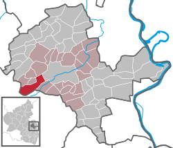 | |
 | |
| Location of Offenheim | |
 Offenheim  Offenheim | |
| Coordinates: 49°43′32″N 08°01′49″E / 49.72556°N 8.03028°E | |
| Country | Germany |
| State | Rhineland-Palatinate |
| District | Alzey-Worms |
| Municipal assoc. | Alzey-Land |
| Government | |
| • Mayor (2019–24) | Peter Odermann[1] |
| Area | |
• Total | 13.86 km2 (5.35 sq mi) |
| Elevation | 229 m (751 ft) |
| Population (2023-12-31)[2] | |
• Total | 648 |
| • Density | 46.8/km2 (121/sq mi) |
| Time zone | UTC+01:00 (CET) |
| • Summer (DST) | UTC+02:00 (CEST) |
| Postal codes | 55234 |
| Dialling codes | 06736 |
| Vehicle registration | AZ |
| Website | www.offenheim.de |
Offenheim (German pronunciation: [ˈɔfn̩haɪm]) is an Ortsgemeinde – a municipality belonging to a Verbandsgemeinde, a kind of collective municipality – in the Alzey-Worms district in Rhineland-Palatinate, Germany.
Location
The municipality, which lies in the middle of the Rhenish-Hessian Switzerland, has 842 ha of woodland, giving it the biggest and almost the only wooded area in Rhenish Hesse. In the Vorholzwald (forest) is found Rhenish Hesse's highest elevation at 358 m above sea level, the Kappelberg. Offenheim belongs to the Verbandsgemeinde of Alzey-Land, whose seat is in Alzey.
History
In 786, Offenheim had its first documentary mention in Lorsch Abbey’s donation directory.
