Baicheng County
From Wikipedia, the free encyclopedia
Baicheng County
Bay, Bai, Paicheng | |
|---|---|
.jpg) | |
.png) Location of Baicheng County (red) in Aksu Prefecture (yellow) and Xinjiang | |
 Baicheng County Location within China  Baicheng County Baicheng County (China) | |
| Coordinates: 41°46′12″N 81°52′12″E / 41.77000°N 81.87000°E | |
| Country | China |
| Autonomous region | Xinjiang |
| Prefecture | Aksu |
| County seat | Bai Town |
| Township-level divisions | 4 towns, 10 townships |
| Area | |
• Total | 15,916.81 km2 (6,145.51 sq mi) |
| Population (2020)[2] | |
• Total | 231,113 |
| • Density | 15/km2 (38/sq mi) |
| Ethnic groups | |
| • Major ethnic groups | Uyghur[3] |
| Time zone | UTC+8 (China Standard[a]) |
| Postal code | 842300 |
| Website | www |
| Baicheng County | |||||||||||
|---|---|---|---|---|---|---|---|---|---|---|---|
| Uyghur name | |||||||||||
| Uyghur | باي ناھىيىسى | ||||||||||
| |||||||||||
| Chinese name | |||||||||||
| Simplified Chinese | 拜城县 | ||||||||||
| Traditional Chinese | 拜城縣 | ||||||||||
| |||||||||||
| Alternative Chinese name | |||||||||||
| Simplified Chinese | 拜县 | ||||||||||
| Traditional Chinese | 拜縣 | ||||||||||
| |||||||||||
Baicheng County[4][5] (Chinese: 拜城县) as the official romanized name, also transliterated from Uyghur as Bay County[6][7][8] (pronounced like 'bye', ⓘ,[9] Uyghur: باي ناھىيىسى;[10] Chinese: 拜县), is a county in Aksu Prefecture of the Xinjiang Uyghur Autonomous Region, China.
In 1882, the county was established.[1][11]
On 6 November 1997, a member of a Xinjiang separatist group, Muhammat Tursun, fatally shot imam Yunus Sidiq Damolla at his mosque in Baicheng County.[12]
According to a report from Radio Free Asia, on February 17, 2015, seventeen Uyghurs (four policemen, nine attackers and four bystanders) were killed after a stabbing incident 150 m (490 ft) from a police station in the county.[13]
On September 18, 2015, a group of terrorists, suspected to be Uyghurs, attacked workers and security guards at the Sogan Colliery in Terek, leaving at up to 50 dead and 50 wounded.[14] A manhunt for the suspects concluded on November 13, with 28 suspects killed and 1 surrendering. In interview with Radio Free Asia, county police officers confirmed that women and children were among those killed in November.[7]
On December 5, 2019 at around 10:46 a.m., a 4.9 magnitude earthquake struck the county (epicenter: 41°44′N 81°39′E / 41.73°N 81.65°E).[4]
Geography
The county is located in the northern part of the prefecture, occupying the valley of the Muzart River between the southern slopes of the Tengritagh and the Qoltagh (却勒塔格山; Quèlètǎgé Shān).
Climate
| Climate data for Baicheng, elevation 1,229 m (4,032 ft), (1991–2020 normals, extremes 1991–present) | |||||||||||||
|---|---|---|---|---|---|---|---|---|---|---|---|---|---|
| Month | Jan | Feb | Mar | Apr | May | Jun | Jul | Aug | Sep | Oct | Nov | Dec | Year |
| Record high °C (°F) | 5.6 (42.1) |
16.8 (62.2) |
25.3 (77.5) |
33.6 (92.5) |
34.2 (93.6) |
36.2 (97.2) |
39.0 (102.2) |
37.7 (99.9) |
34.2 (93.6) |
28.3 (82.9) |
19.2 (66.6) |
7.3 (45.1) |
39.0 (102.2) |
| Mean daily maximum °C (°F) | −4.3 (24.3) |
2.7 (36.9) |
12.9 (55.2) |
21.3 (70.3) |
25.8 (78.4) |
29.1 (84.4) |
30.8 (87.4) |
29.9 (85.8) |
25.4 (77.7) |
18.1 (64.6) |
7.5 (45.5) |
−2.3 (27.9) |
16.4 (61.5) |
| Daily mean °C (°F) | −11.3 (11.7) |
−4.5 (23.9) |
5.4 (41.7) |
13.4 (56.1) |
17.8 (64.0) |
20.7 (69.3) |
22.1 (71.8) |
21.1 (70.0) |
16.5 (61.7) |
8.6 (47.5) |
0.1 (32.2) |
−8.2 (17.2) |
8.5 (47.3) |
| Mean daily minimum °C (°F) | −16.6 (2.1) |
−10.3 (13.5) |
−1.1 (30.0) |
6.0 (42.8) |
10.4 (50.7) |
13.1 (55.6) |
14.9 (58.8) |
14.0 (57.2) |
9.7 (49.5) |
1.9 (35.4) |
−4.7 (23.5) |
−12.2 (10.0) |
2.1 (35.8) |
| Record low °C (°F) | −28.7 (−19.7) |
−28.1 (−18.6) |
−9.6 (14.7) |
−5.0 (23.0) |
−0.2 (31.6) |
4.9 (40.8) |
8.3 (46.9) |
7.3 (45.1) |
0.8 (33.4) |
−5.7 (21.7) |
−18.8 (−1.8) |
−25.0 (−13.0) |
−28.7 (−19.7) |
| Average precipitation mm (inches) | 3.3 (0.13) |
4.9 (0.19) |
4.8 (0.19) |
7.5 (0.30) |
13.4 (0.53) |
23.9 (0.94) |
22.1 (0.87) |
22.5 (0.89) |
16.7 (0.66) |
11.1 (0.44) |
5.0 (0.20) |
2.5 (0.10) |
137.7 (5.44) |
| Average precipitation days (≥ 0.1 mm) | 5.3 | 3.2 | 2.5 | 3.0 | 5.4 | 9.1 | 10.4 | 9.1 | 6.8 | 2.8 | 2.1 | 4.0 | 63.7 |
| Average snowy days | 8.9 | 5.5 | 1.6 | 0.2 | 0 | 0 | 0 | 0 | 0 | 0.2 | 2.5 | 8.1 | 27 |
| Average relative humidity (%) | 76 | 71 | 56 | 45 | 48 | 56 | 60 | 62 | 66 | 68 | 76 | 80 | 64 |
| Mean monthly sunshine hours | 184.4 | 200.5 | 240.1 | 258.9 | 294.1 | 295.7 | 308.2 | 291.5 | 266.3 | 254.3 | 200.4 | 161.0 | 2,955.4 |
| Percentage possible sunshine | 62 | 66 | 64 | 64 | 65 | 65 | 68 | 69 | 73 | 76 | 69 | 57 | 67 |
| Source: China Meteorological Administration[15][16] | |||||||||||||
Administrative divisions
Baicheng County administered 4 towns and 10 townships[1][17]
| Name | Simplified Chinese | Hanyu Pinyin | Uyghur (UEY) | Uyghur Latin (ULY) | Administrative division code | Notes | |
|---|---|---|---|---|---|---|---|
| Towns | |||||||
| Bai Town | 拜城镇 | Bàichéng Zhèn | باي بازىرى | bay baziri | 652926100 | ||
| Tirek Town | 铁热克镇 | Tiěrèkè Zhèn | تېرەك بازىرى | tërek baziri | 652926101 | ||
| Qarqi Town[18] (Yaqeriq) |
察尔齐镇 | Chá'ěrqí Zhèn | ياقىئېرىق بازىرى | yaqi'ëriq baziri | 652926102 | ||
| Sayram Town[19] | 赛里木镇 | Sàilǐmù Zhèn | سايرام بازىرى | sayram baziri | 652926103 | birthplace of the historian Musa Sayrami | |
| Townships | |||||||
| Qeyir Township | 黑英山乡 | Hēiyīngshān Xiāng | قېيىر يېزىسى | qëyir yëzisi | 652926200 | ||
| Kizil Township | 克孜尔乡 | Kèzī'ěr Xiāng | قىزىل يېزىسى | qizil yëzisi | 652926201 | site of a number of Buddhist grotto sites, including Kizil Caves | |
| Toqsun Township | 托克逊乡 | Tuōkèxùn Xiāng | توقسۇن يېزىسى | toqsun yëzisi | 652926203 | ||
| Yatur Township | 亚吐尔乡 | Yàtǔ'ěr Xiāng | ياتۇر يېزىسى | yatur yëzisi | 652926204 | ||
| Kanchi Township[20] | 康其乡 | Kāngqí Xiāng | كانچى يېزىسى | kanchi yëzisi | 652926205 | ||
| Bulung Township | 布隆乡 | Bùlóng Xiāng | بۇلۇڭ يېزىسى | bulung yëzisi | 652926206 | ||
| Miqigh Township | 米吉克乡 | Mǐjíkè Xiāng | مىچىغ يېزىسى | michigh yëzisi | 652926207 | ||
| Onbash Township | 温巴什乡 | Wēnbāshí Xiāng | ئومباش يېزىسى | Ombash yëzisi | 652926208 | ||
| Chong Kowruk Township | 大桥乡 | Dàqiáo Xiāng | چوڭ كۆۋرۈك يېزىسى | chong köwrük yëzisi | 652926209 | ||
| Qarabagh Township | 老虎台乡 | Láohǔtái Xiāng | قاراباغ يېزىسى | qarabagh yëzisi | 652926210 | ||
Economy
The county's economy is based on agriculture and produces rapeseed in abundance. Animal husbandry is also common. Mineral resources are rich. Industries include coal, iron, electronics, fertilizer, tractors, vegetable oil extraction, etc. The Tianshan Mountains have lush spruce forests.[11]
As of 1885[update], there was about 67,500 acres (445,577 mu) of cultivated land in Bay.[21]
Demographics
| Year | Pop. | ±% p.a. |
|---|---|---|
| 2000 | 203,665 | — |
| 2010 | 229,252 | +1.19% |
| [1] | ||
As of 2015, 212,272 of the 241,079 residents of the county were Uyghur, 26,559 were Han Chinese and 2,248 were from other ethnic groups.[22]
According to the 2002 census, it has a population of 200,000.[citation needed]
As of 1999, 87.03% of the population of the county were Uyghur and 12.08% of the population was Han Chinese.[23]
Transportation
Historical maps
Historical English-language maps including the county:
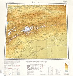 Map including the county (labeled as PAI-CH'ENG (BAI)) and surrounding region from the International Map of the World (AMS, 1950)[b]
 Map including the county (labeled as BAICHENG) (DMA, 1981)
_-_panoramio.jpg)

