Bazoches-au-Houlme
From Wikipedia, the free encyclopedia
Bazoches-au-Houlme | |
|---|---|
 A view within Bazoches-au-Houlme | |
Location of Bazoches-au-Houlme  | |
 Bazoches-au-Houlme  Bazoches-au-Houlme | |
| Coordinates: 48°49′06″N 0°14′22″W / 48.8183°N 0.2394°W | |
| Country | France |
| Region | Normandy |
| Department | Orne |
| Arrondissement | Argentan |
| Canton | Athis-Val de Rouvre |
| Intercommunality | Val d'Orne |
| Government | |
| • Mayor (2020–2026) | Alix Dauger[1] |
Area 1 | 28.64 km2 (11.06 sq mi) |
| Population (2022)[2] | 455 |
| • Density | 16/km2 (41/sq mi) |
| Time zone | UTC+01:00 (CET) |
| • Summer (DST) | UTC+02:00 (CEST) |
| INSEE/Postal code | 61028 /61210 |
| Elevation | 90–230 m (300–750 ft) (avg. 183 m or 600 ft) |
| 1 French Land Register data, which excludes lakes, ponds, glaciers > 1 km2 (0.386 sq mi or 247 acres) and river estuaries. | |
Bazoches-au-Houlme (French pronunciation: [bazɔʃ o ulm]) is a commune in the Orne department in northwestern France.
Geography
The commune of Bazoches-au-Houlme is part of the area known as Suisse Normande.[3]
The commune is made up of the following collection of villages and hamlets, Bazoches-au-Houlme, La Guilberdière, Le Pont de Baize and La Thiboudière. The commune is spread over an area of 28.64 square kilometres (7,080 acres) with a maximum altitude of 230 metres (754 ft 7 in) and minimum of 90 metres (295 ft 3 in)[4]
The river Baize runs through the commune, along with four of its tributaries, Ruisseau des Vaux Viets, Ruisseau du Val Lienard, Ruisseau du Val and Ruisseau des Vallees.[5]
Neighbouring communes[6] | ||||||||||||||||
|---|---|---|---|---|---|---|---|---|---|---|---|---|---|---|---|---|
| ||||||||||||||||
Land distribution
The 2018 CORINE Land Cover assessment shows the vast majority of the land in the commune, 56% (1,607 hectares (3,970 acres)) is Arable land.[4] The rest of the land is Meadows at 37%, Forests are 4% and rest of land is equally shared by Heterogeneous agricultural, Artificial, non-agricultural green spaces and urbanised areas.[4]
Notable buildings and places
National heritage sites
- Saint-Pierre Church is a church built during the 12th century that contains a group of sculptures of The Virgin Bringing Communion to Saint Avoie, from the old church of Saint-Pavin is classed as a Monument historique.[7]
- Château de Bazoches-au-Houlme is a stately home built in many stages. At first it was castle fortress remnants from the 12th century that was partly destroyed by Geoffrey Plantagenet with a watchtower that was built in the 14th century added to the structure. Later in the 15th to 18th century a stately home was added to the structure. This is classed as a Monument historique.[8]
 Saint-Pierre Church
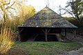 Bazoches-au-Houlme lavoir


Notable people
- Remy de Gourmont, a French symbolist poet, novelist, and influential critic, was born in Bazoches-au-Houlme.[9]
- Maurice Ephrussi, owned the Haras du Gazon, a breeding farm in Bazoches-au-Houlme which produced several horses of notable ability.[10]