Chama, Costilla County, Colorado
From Wikipedia, the free encyclopedia
Chama, Colorado | |
|---|---|
 County Road L.7 in Chama. | |
  Chama Location of Chama, Colorado.  Chama Chama (Colorado) | |
| Coordinates: 37°09′43″N 105°22′42″W / 37.1620°N 105.3783°W[1] | |
| Country | United States |
| State | Colorado |
| County | Costilla[2] |
| Established | 1860[3] |
| Government | |
| • Type | unincorporated community |
| • Body | Costilla County[2] |
| Elevation | 8,186 ft (2,495 m) |
| Population | |
• Total | 63 |
| Time zone | UTC−07:00 (MST) |
| • Summer (DST) | UTC−06:00 (MDT) |
| ZIP code[4] | 81126 |
| Area code | 719 |
| GNIS pop ID | 203659 |
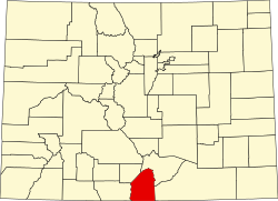
Chama is an unincorporated community and U.S. Post Office located in Costilla County, Colorado, United States.
Chama is located in the Rio Culebra valley which is part of the Sangre de Cristo Land Grant was awarded to the family of Carlos Beaubien in 1843 by the government of New Mexico. The town of Chama was established by settlers from Chamita, New Mexico, in 1860.[3] The Chama, Colorado, post office opened on May 3, 1907.[5] The Chama school was taken down between the years of 1999 and 2001.