Eastdale, Colorado
From Wikipedia, the free encyclopedia
CountryUnited States
Elevation7,533 ft (2,296 m)
Eastdale, Colorado | |
|---|---|
 Eastdale Location of Eastdale, Colorado.  Eastdale Eastdale (Colorado) | |
| Coordinates: 37°01′43″N 105°39′03″W / 37.0286°N 105.6508°W[1] | |
| Country | United States |
| State | Colorado |
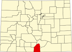
| County | Costilla[2] |
| Elevation | 7,533 ft (2,296 m) |
| Time zone | UTC−07:00 (MST) |
| • Summer (DST) | UTC−06:00 (MDT) |
| ZIP code[3] | (San Luis) 81152 |
| Area code | 719 |
| GNIS place ID | 193111 |
Eastdale is an extinct town in Costilla County, in the U.S. state of Colorado.[4] Eastdale was a farming community on the Colorado/New Mexico border.