Glen, Montana
From Wikipedia, the free encyclopedia
Glen, Montana | |
|---|---|
 Interactive map of Glen, Montana | |
| Coordinates: 45°28′44″N 112°41′31″W / 45.47889°N 112.69194°W | |
| Country |  United States United States |
| State |  Montana Montana |
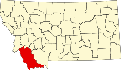
| County | Beaverhead |
| Area | |
• Total | 0.29 sq mi (0.75 km2) |
| • Land | 0.29 sq mi (0.75 km2) |
| • Water | 0 sq mi (0.00 km2) |
| Elevation | 4,987 ft (1,520 m) |
| Population (2020) | |
• Total | 28 |
| • Density | 96.2/sq mi (37.14/km2) |
| FIPS code | 30-31375 |
| GNIS feature ID | 2804252[2] |
Glen is a census-designated place in Beaverhead County, Montana, United States.[2] As of the 2020 census, Glen had a population of 28.[3] Glen has a post office with a ZIP code of 59732.[4]
Glen started out in 1878 as Willis Station, named for Ozias Willis, the first postmaster.[5] The name was shortened to Willis, then became Reichle, and finally became Glen in about 1950.[5]
Glen lies on U.S. Route 91, south of Melrose and north of Dillon. The Big Hole River runs past the east side of the town. Built in 1915, Browne's Bridge near town is listed on the National Register of Historic Places and provides a fishing access area.[6][7] The river is renowned as a fly fishing destination.[8] Brownes Lake is also nearby and provides a boat ramp and camping.[9]