Grant, Montana
From Wikipedia, the free encyclopedia
CountryUnited States
Elevation5,807 ft (1,770 m)
Grant, Montana | |
|---|---|
 Grant  Grant | |
| Coordinates: 45°00′35″N 113°04′03″W / 45.00972°N 113.06750°W | |
| Country | United States |
| State | Montana |
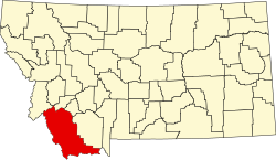
| County | Beaverhead |
| Area | |
• Total | 1.75 sq mi (4.53 km2) |
| • Land | 1.75 sq mi (4.53 km2) |
| • Water | 0 sq mi (0.00 km2) |
| Elevation | 5,807 ft (1,770 m) |
| Population (2020) | |
• Total | 19 |
| • Density | 10.9/sq mi (4.19/km2) |
| Time zone | UTC-7 (Mountain (MST)) |
| • Summer (DST) | UTC-6 (MDT) |
| ZIP Code | 59725 (Dillon) |
| Area code | 406 |
| FIPS code | 30-32350 |
| GNIS feature ID | 2804260[2] |
Grant is an unincorporated community and census-designated place (CDP) in Beaverhead County, Montana, United States. It is in the west-central part of the county, along Secondary Highway 324, 12 miles (19 km) west of Interstate 15 and 31 miles (50 km) southwest of Dillon, the county seat.
Grant was first listed as a CDP prior to the 2020 census.[2]
As of the 2020 census, Grant had a population of 19.[3]