List of extreme summits of Central America
From Wikipedia, the free encyclopedia
This article comprises four sortable tables of mountain summits of Central America that are the higher than any other point north or south of their latitude or east or west their longitude in the region.
The summit of a mountain or hill may be measured in three principal ways:
- The topographic elevation of a summit measures the height of the summit above a geodetic sea level.[1]
- The topographic prominence of a summit is a measure of how high the summit rises above its surroundings.[2][3][1]
- The topographic isolation (or radius of dominance) of a summit measures how far the summit lies from its nearest point of equal elevation.[4]
| Rank | Mountain Peak | Country | Mountain range | Elevation | Prominence | Isolation | Location |
|---|---|---|---|---|---|---|---|
| 5 | Doyle's Delight[5][a][b] |  Belize Belize |
Yucatán Peninsula | 1174 m 3,852 ft | 500 m 1,640 ft | 138.3 km 85.9 mi |
16°29′39″N 89°02′44″W / 16.4941°N 89.0456°W |
| 4 | Pico Bonito[6][c] |  Honduras Honduras |
Cordillera Nombre de Dios | 2450 m 8,038 ft | 1710 m 5,610 ft | 151 km 93.8 mi |
15°33′27″N 86°52′32″W / 15.5575°N 86.8756°W |
| 3 | Alto Cuchumatanes[7][d] |  Guatemala Guatemala |
Huehuetenango | 3837 m 12,589 ft | 1877 m 6,158 ft | 65.2 km 40.5 mi |
15°31′06″N 91°32′40″W / 15.5182°N 91.5445°W |
| 2 | Volcán Tacaná[8][9][e] |  Chiapas Guatemala Chiapas Guatemala |
Sierra de Istatan | 4067 m 13,343 ft | 1037 m 3,402 ft | 24.1 km 14.99 mi |
15°07′56″N 92°06′30″W / 15.1323°N 92.1084°W |
| 1 | Volcán Tajumulco[10][f][g] | Guatemala |
Sierra de las Nubes | 4220 m 13,845 ft | 3990 m 13,091 ft | 722 km 448 mi |
15°02′35″N 91°54′13″W / 15.0430°N 91.9037°W |
Southernmost high summits
| Rank | Mountain Peak | Country | Mountain range | Elevation | Prominence | Isolation | Location |
|---|---|---|---|---|---|---|---|
| 6 | Cerro Hoya[11][h] |  Panama Panama |
Azuero Peninsula | 1559 m 5,115 ft | 500 m 1,640 ft | 135.7 km 84.3 mi |
7°19′04″N 80°40′52″W / 7.3179°N 80.6810°W |
| 5 | Cerro Tacarcuna[12][i] | Panama |
Darién | 1875 m 6,152 ft | 1770 m 5,807 ft | 174.4 km 108.3 mi |
8°09′57″N 77°17′45″W / 8.1659°N 77.2959°W |
| 4 | Volcán Barú[13][j][k] | Panama |
Chiriquí | 3474 m 11,398 ft | 1324 m 4,344 ft | 74.2 km 46.1 mi |
8°48′32″N 82°32′34″W / 8.8088°N 82.5427°W |
| 3 | Chirripó Grande[14][l][m] (Cerro Chirripó) |
 Costa Rica Costa Rica |
Cordillera de Talamanca | 3819 m 12,530 ft | 3755 m 12,320 ft | 878 km 546 mi |
9°29′03″N 83°29′20″W / 9.4843°N 83.4889°W |
| 2 | Volcán Acatenango[15][n] | Guatemala |
Chimaltenango | 3975 m 13,041 ft | 1835 m 6,020 ft | 125.9 km 78.2 mi |
14°30′06″N 90°52′32″W / 14.5016°N 90.8755°W |
| 1 | Volcán Tajumulco[10][f][g] | Guatemala |
Sierra de las Nubes | 4220 m 13,845 ft | 3990 m 13,091 ft | 722 km 448 mi |
15°02′35″N 91°54′13″W / 15.0430°N 91.9037°W |
Easternmost high summits
| Rank | Mountain Peak | Country | Mountain range | Elevation | Prominence | Isolation | Location |
|---|---|---|---|---|---|---|---|
| 5 | Cerro Tacarcuna[12][i] | Panama |
Darién | 1875 m 6,152 ft | 1770 m 5,807 ft | 174.4 km 108.3 mi |
8°09′57″N 77°17′45″W / 8.1659°N 77.2959°W |
| 4 | Volcán Barú[13][j][k] | Panama |
Chiriquí | 3474 m 11,398 ft | 1324 m 4,344 ft | 74.2 km 46.1 mi |
8°48′32″N 82°32′34″W / 8.8088°N 82.5427°W |
| 3 | Chirripó Grande[14][l][m] (Cerro Chirripó) |
Costa Rica |
Cordillera de Talamanca | 3819 m 12,530 ft | 3755 m 12,320 ft | 878 km 546 mi |
9°29′03″N 83°29′20″W / 9.4843°N 83.4889°W |
| 2 | Volcán Acatenango[15][n] | Guatemala |
Chimaltenango | 3975 m 13,041 ft | 1835 m 6,020 ft | 125.9 km 78.2 mi |
14°30′06″N 90°52′32″W / 14.5016°N 90.8755°W |
| 1 | Volcán Tajumulco[10][f][g] | Guatemala |
Sierra de las Nubes | 4220 m 13,845 ft | 3990 m 13,091 ft | 722 km 448 mi |
15°02′35″N 91°54′13″W / 15.0430°N 91.9037°W |
Westernmost high summits
Volcán Tacaná and Volcán Tajumulco are the two highest summits of Central America.
| Rank | Mountain Peak | Country | Mountain range | Elevation | Prominence | Isolation | Location |
|---|---|---|---|---|---|---|---|
| 2 | Volcán Tacaná[8][9][e] | Chiapas Guatemala |
Sierra de Istatan | 4067 m 13,343 ft | 1037 m 3,402 ft | 24.1 km 14.99 mi |
15°07′56″N 92°06′30″W / 15.1323°N 92.1084°W |
| 1 | Volcán Tajumulco[10][f][g] | Guatemala |
Sierra de las Nubes | 4220 m 13,845 ft | 3990 m 13,091 ft | 722 km 448 mi |
15°02′35″N 91°54′13″W / 15.0430°N 91.9037°W |
Gallery

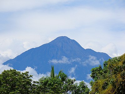 Volcán Tacaná on the border between Guatemala and Mexico is the second highest major summit of Central America.


See also


- List of mountain peaks of North America
- List of mountain peaks of Greenland
- List of mountain peaks of Canada
- List of mountain peaks of the Rocky Mountains
- List of mountain peaks of the United States
- List of mountain peaks of Mexico
- List of mountain peaks of Central America
- List of the ultra-prominent summits of Central America
- List of extreme summits of Central America
- List of mountain peaks of the Caribbean
- Central America
- Physical geography


